Introduction
Land Records & GIS Cadastral Systems are digital platforms that manage, store, and visualize land ownership, parcel boundaries, and cadastral data using geographic information systems (GIS). They provide governments, survey authorities, and land management agencies with accurate maps, legal records, and spatial analytics to streamline land administration and property transactions. as urbanization, real estate development, and smart city initiatives accelerate, these systems are increasingly important. They improve data accuracy, regulatory compliance, and operational efficiency while reducing disputes over land ownership. Modern cadastral platforms integrate AI and spatial analytics for faster land surveying, digital approvals, and real-time reporting.
Real-world use cases include:
- Municipal land management and planning
- Property registration and transfer
- Taxation and valuation of parcels
- Dispute resolution for land ownership
- Infrastructure and utility planning using spatial overlays
What buyers should evaluate:
- Accuracy and completeness of cadastral mapping
- Integration with GIS and survey instruments
- Data security and audit capabilities
- Ease of use for non-technical staff
- Mobile access for field surveyors
- Reporting and analytics for governance
- Support for automation and AI-based data validation
- Compliance with national and regional land registry standards
- Scalability for growing urban areas
Best for: government land departments, cadastral survey agencies, municipal planning authorities, and large-scale real estate developers.
Not ideal for: small land offices with minimal digitization needs; manual spreadsheets may suffice in such cases.
Key Trends in Land Records & GIS Cadastral Systems
- AI-assisted cadastral mapping and land boundary recognition
- Cloud-native GIS solutions for centralization and accessibility
- Integration with national e-governance and land registry platforms
- Mobile apps for field surveyors and inspectors
- Real-time updates and synchronization with survey instruments
- Automated land valuation and tax calculation
- Blockchain-based land ownership verification for tamper-proof records
- Interoperability with urban planning, utilities, and infrastructure management systems
- Open API frameworks enabling third-party analytics and applications
- Subscription-based SaaS pricing replacing traditional on-premise software
How We Selected These Tools (Methodology)
- Market adoption and widespread use among government and cadastral agencies
- Completeness of mapping, recording, and GIS functionalities
- Reliability and performance in large-scale land management
- Security posture including encryption, audit logs, and role-based access
- Ecosystem integration with survey instruments, GIS platforms, and ERP systems
- Customer fit across solo survey offices, municipalities, and state-level departments
- Scalability to accommodate urban expansion and large parcel datasets
- Vendor support quality and documentation
- Flexibility for mobile, web, and hybrid deployment models
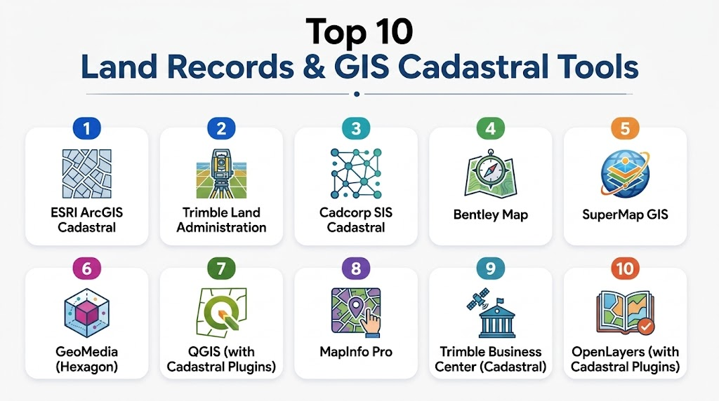
Top 10 Land Records & GIS Cadastral Systems
1- ESRI ArcGIS Cadastral
Short description: Enterprise GIS platform for managing cadastral data, parcel mapping, and land administration workflows.
Key Features
- Parcel and boundary mapping
- Land ownership and property records management
- Mobile GIS for field surveys
- Spatial analysis and reporting
- Integration with surveying instruments
- Automated validation and quality control
Pros
- Robust GIS capabilities
- Scalable for large government datasets
Cons
- High implementation complexity
- Licensing cost may be significant
Platforms / Deployment
- Web, Windows, iOS, Android
- Cloud / Hybrid
Security & Compliance
Not publicly stated
Integrations & Ecosystem
Supports ERP, survey instruments, and GIS plugins.
- Survey instruments integration
- ERP and property tax systems
- GIS analytics extensions
- API for external applications
Support & Community
Comprehensive support, strong user community, extensive documentation
2- Trimble Land Administration
Short description: GIS-enabled cadastral and land records system focused on surveying, mapping, and land management.
Key Features
- Land parcel and boundary management
- Mobile field data collection
- Automated mapping and surveying workflows
- Reporting dashboards
- Integration with GIS and ERP systems
Pros
- Field-friendly mobile applications
- Good integration with surveying instruments
Cons
- Complexity for smaller offices
- May require specialized GIS expertise
Platforms / Deployment
- Windows, Web, iOS, Android
- Cloud / On-premise
Security & Compliance
Not publicly stated
Integrations & Ecosystem
- Survey instruments
- GIS platforms
- ERP systems
- API extensions
Support & Community
Vendor support and online resources
3- Cadcorp SIS Cadastral
Short description: Comprehensive GIS platform with cadastral management, parcel mapping, and land registry features.
Key Features
- Parcel mapping and land record management
- Spatial analysis tools
- Web and desktop GIS applications
- Reporting and analytics
- GIS data visualization
Pros
- Strong spatial analytics
- Suitable for government and utility agencies
Cons
- Limited out-of-the-box automation
- May require technical GIS expertise
Platforms / Deployment
- Web, Windows, macOS
- Cloud / On-premise
Security & Compliance
Not publicly stated
Integrations & Ecosystem
- GIS layers
- Surveying instruments
- ERP and tax systems
- API support
Support & Community
Documentation and vendor support
4- Bentley Map
Short description: Advanced GIS and cadastral platform for mapping, surveying, and land record management.
Key Features
- Cadastral mapping
- Land and property records
- GIS analysis
- Field survey integration
- Data reporting and visualization
Pros
- High precision for large-scale mapping
- Integrates with engineering workflows
Cons
- Complex setup
- Higher cost for smaller municipalities
Platforms / Deployment
- Windows, Web
- Cloud / On-premise
Security & Compliance
Not publicly stated
Integrations & Ecosystem
- Engineering and survey instruments
- GIS data layers
- API extensions
Support & Community
Vendor support and technical community
5- SuperMap GIS
Short description: GIS platform supporting cadastral data management, mapping, and spatial analysis.
Key Features
- Land parcel management
- Spatial analysis and visualization
- Mobile data collection
- Reporting and dashboards
- GIS data integration
Pros
- Affordable GIS solution
- Supports field mobile collection
Cons
- Interface may be less intuitive
- Limited global adoption
Platforms / Deployment
- Web, Windows, iOS, Android
- Cloud / On-premise
Security & Compliance
Not publicly stated
Integrations & Ecosystem
- Survey instruments
- ERP and GIS systems
- API for extensions
Support & Community
Vendor support and online documentation
6- GeoMedia (Hexagon)
Short description: Enterprise GIS solution with cadastral mapping, property records, and spatial analytics.
Key Features
- Land parcel and boundary management
- GIS spatial analytics
- Web and desktop mapping
- Integration with ERP
- Reporting dashboards
Pros
- Strong GIS analytics
- Suitable for municipal agencies
Cons
- Requires GIS expertise
- Higher deployment cost
Platforms / Deployment
- Windows, Web
- Cloud / On-premise
Security & Compliance
Not publicly stated
Integrations & Ecosystem
- ERP systems
- Survey instruments
- GIS data layers
Support & Community
Vendor support and online forums
7- QGIS with Cadastral Plugins
Short description: Open-source GIS platform with plugins for cadastral management and parcel mapping.
Key Features
- Parcel and boundary mapping
- Open-source extensibility
- GIS spatial analysis
- Mobile field data support
- Reporting and dashboards
Pros
- Free and open-source
- Flexible and extensible
Cons
- Requires technical knowledge
- Limited vendor support
Platforms / Deployment
- Windows, macOS, Linux
- Self-hosted / Cloud (Varies)
Security & Compliance
Varies / N/A
Integrations & Ecosystem
- GIS plugins
- ERP connectors
- Surveying instruments
Support & Community
Active community, documentation available
8- MapInfo Pro
Short description: GIS desktop platform with cadastral and land records management tools.
Key Features
- Parcel mapping and land registry
- GIS visualization and analysis
- Reporting and dashboards
- Integration with survey tools
- Desktop and mobile support
Pros
- Strong visualization capabilities
- Stable enterprise solution
Cons
- Less cloud-native
- Limited mobile features
Platforms / Deployment
- Windows, Web
- On-premise / Hybrid
Security & Compliance
Not publicly stated
Integrations & Ecosystem
- GIS data layers
- Surveying instruments
- ERP integration
Support & Community
Vendor support and user forums
9- Trimble Business Center (Cadastral)
Short description: GIS and surveying solution for land records and cadastral management.
Key Features
- Land parcel mapping
- Integration with survey instruments
- GIS visualization
- Reporting and analytics
- Mobile support
Pros
- Field survey integration
- Accurate data management
Cons
- Requires training
- Cost may be high for smaller agencies
Platforms / Deployment
- Windows
- Cloud / On-premise
Security & Compliance
Not publicly stated
Integrations & Ecosystem
- Survey instruments
- GIS systems
- ERP integration
Support & Community
Vendor support, documentation
10- OpenLayers with Cadastral Plugins
Short description: Open-source web GIS platform suitable for cadastral mapping and land record visualization.
Key Features
- Parcel mapping and visualization
- Open-source extensibility
- Web GIS deployment
- Reporting and dashboards
- API for third-party apps
Pros
- Free and flexible
- Web-native deployment
Cons
- Requires development expertise
- Limited out-of-the-box features
Platforms / Deployment
- Web
- Self-hosted / Cloud (Varies)
Security & Compliance
Varies / N/A
Integrations & Ecosystem
- GIS layers and plugins
- ERP connectors
- Survey data integration
Support & Community
Active developer community, documentation
Comparison Table (Top 10)
| Tool Name | Best For | Platform(s) Supported | Deployment | Standout Feature | Public Rating |
|---|---|---|---|---|---|
| ESRI ArcGIS Cadastral | Large municipalities | Web, Windows, iOS, Android | Cloud/Hybrid | Advanced GIS analysis | N/A |
| Trimble Land Administration | Survey & mapping | Web, Windows, iOS, Android | Cloud/On-prem | Field survey integration | N/A |
| Cadcorp SIS Cadastral | Government & utility agencies | Web, Windows, macOS | Cloud/On-prem | Spatial analytics | N/A |
| Bentley Map | Engineering & cadastral | Windows, Web | Cloud/On-prem | Integration with engineering workflows | N/A |
| SuperMap GIS | Municipal & regional | Web, Windows, iOS, Android | Cloud/On-prem | Affordable GIS solution | N/A |
| GeoMedia (Hexagon) | Municipal GIS | Windows, Web | Cloud/On-prem | Spatial analytics | N/A |
| QGIS with Plugins | Open-source users | Windows, macOS, Linux | Self-hosted / Cloud | Extensible GIS | N/A |
| MapInfo Pro | Visualization & mapping | Windows, Web | On-prem / Hybrid | Data visualization | N/A |
| Trimble Business Center | Survey-heavy cadastral | Windows | Cloud/On-prem | Field integration | N/A |
| OpenLayers with Plugins | Web GIS developers | Web | Self-hosted / Cloud | Web-native mapping | N/A |
Evaluation & Scoring of Land Records & GIS Cadastral Systems
| Tool Name | Core (25%) | Ease (15%) | Integrations (15%) | Security (10%) | Performance (10%) | Support (10%) | Value (15%) | Weighted Total |
|---|---|---|---|---|---|---|---|---|
| ESRI ArcGIS | 9 | 7 | 8 | 8 | 8 | 8 | 7 | 8.1 |
| Trimble Land Admin | 8 | 7 | 8 | 7 | 8 | 7 | 7 | 7.5 |
| Cadcorp SIS | 8 | 6 | 7 | 7 | 7 | 7 | 7 | 7.3 |
| Bentley Map | 8 | 6 | 7 | 7 | 7 | 7 | 7 | 7.3 |
| SuperMap GIS | 7 | 7 | 6 | 6 | 7 | 7 | 8 | 7.0 |
| GeoMedia (Hexagon) | 8 | 6 | 7 | 7 | 7 | 7 | 7 | 7.3 |
| QGIS Plugins | 7 | 6 | 6 | 6 | 6 | 6 | 8 | 6.8 |
| MapInfo Pro | 7 | 6 | 6 | 6 | 7 | 7 | 7 | 6.9 |
| Trimble Business Center | 8 | 6 | 7 | 7 | 7 | 7 | 7 | 7.3 |
| OpenLayers Plugins | 7 | 6 | 6 | 6 | 6 | 6 | 8 | 6.8 |
Which Land Records & GIS Cadastral System Is Right for You?
Solo / Freelancer
Open-source options like QGIS or OpenLayers are ideal for individuals or small survey teams.
SMB
Mid-sized municipalities benefit from SuperMap GIS or Trimble Land Administration for affordability and field survey support.
Mid-Market
Regional agencies can deploy Cadcorp SIS or Bentley Map for scalable GIS analytics and cadastral management.
Enterprise
Large-scale governments should consider ESRI ArcGIS or GeoMedia (Hexagon) for enterprise-grade spatial analytics, multi-agency collaboration, and regulatory compliance.
Budget vs Premium
Open-source tools minimize costs but require technical expertise. Premium solutions offer comprehensive functionality with vendor support.
Feature Depth vs Ease of Use
Premium platforms provide depth and automation; lighter GIS solutions prioritize usability and flexibility.
Integrations & Scalability
Select systems like ESRI ArcGIS for large-scale, multi-department deployments needing ERP, survey, and GIS integrations.
Security & Compliance Needs
Agencies handling sensitive land and property data should prioritize platforms with encryption, audit logs, and role-based access.
Frequently Asked Questions (FAQs)
1- What are typical pricing models?
Most systems are subscription-based or license-based. Open-source tools are free but may require technical support.
2- How long does implementation take?
Small deployments may launch in weeks; enterprise solutions often require months of configuration and training.
3- Can these platforms handle large datasets?
Yes, enterprise-grade GIS systems can manage millions of parcels with high-performance analytics.
4- Are mobile field survey features included?
Many platforms support iOS/Android apps for field data collection and inspections.
5- How secure are these systems?
High-end platforms offer encryption, audit logs, and role-based access, while open-source tools rely on IT configurations.
6- Can they integrate with ERP and tax systems?
Yes, integration with accounting, land tax, and municipal ERP systems is common through APIs.
7- Do they support citizen-facing portals?
Many GIS cadastral systems include web portals for property queries and applications.
8- Are open-source solutions reliable?
Yes, but they may require more technical expertise for maintenance and updates.
9- What are common mistakes during deployment?
Underestimating training needs, neglecting integration planning, or failing to validate data quality.
10- How scalable are these platforms?
Enterprise-grade platforms scale from local survey offices to national-level cadastral management.
Conclusion
Land Records & GIS Cadastral Systems are essential for modern land administration, ensuring accuracy, compliance, and transparency. Selection depends on agency size, GIS expertise, integration needs, and budget. Agencies should shortlist 2–3 systems, run pilots to validate workflows, and confirm integration and security requirements before full deployment. Investing in the right cadastral system enables efficient land management, reduces disputes, and supports data-driven decision-making.
Find Trusted Cardiac Hospitals
Compare heart hospitals by city and services — all in one place.
Explore Hospitals
Land records and cadastral systems provide the greatest value when they combine accurate property records with GIS-based mapping in a single platform. This integration improves transparency, streamlines land administration, reduces ownership disputes, and enables faster, data-driven decisions for planning and property management.